The River That Feeds the Sea: What Aghanashini Still Teaches Us
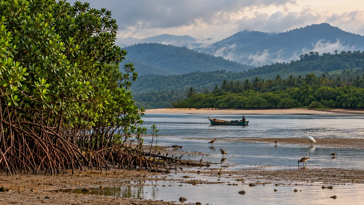
Image credit: AI-generated with OpenAI ImageGen for Humming Genesis; illustrative, not a documentary photograph.
At the mouth of the Aghanashini River, the landscape refuses to stay in one category. It is river and sea, fresh water and salt, mudflat and mangrove, bird habitat and working landscape. At low tide, the estuary opens out into a broad, textured world of channels and exposed mud. As the tide returns, the boundaries shift again.
This is not an empty space where a river happens to meet the sea. It is a productive ecosystem that supports wildlife and people at the same time. Researchers from the Indian Institute of Science have documented the ecological richness of the Aghanashini estuary in Uttara Kannada, including its mangroves, birdlife, fish and edible bivalves. The estuary is a Ramsar wetland of international importance, designated in February 2023 and announced in January 2024, recognition of its significance beyond the villages that live beside it.
The story begins far inland. The Aghanashini rises in the Western Ghats and travels west towards the Arabian Sea. Water moving through its catchment carries nutrients and organic material downstream. In the estuary, the meeting of river flow and tides helps circulate water and nutrients. Mangrove roots shelter young fish and prawns; mudflats support bivalves and feeding birds; the wider food web links the river’s forested catchment to coastal waters.
It is tempting to talk about each of these elements separately. A forest is a forest, a mangrove is a mangrove, a fishery is a livelihood. But the Aghanashini makes the connections visible. What happens upstream can affect what reaches the estuary. What happens to mangroves can influence habitat and productivity. What happens to the mudflats can affect both wildlife and the people who gather shellfish there.
A 2012 technical report on the estuary by IISc’s Energy and Wetlands Research Group describes how bivalve harvesting has long contributed to local food and livelihoods. It also reported that rising demand from outside markets, especially Goa, was already driving over-harvesting of a resource that had historically served local needs, and warned that this could threaten its sustainability within a few years. That tension is familiar in many places: a resource can appear abundant until access to a larger market changes the speed and scale of extraction. A practice that once sustained nearby communities can become harder to sustain when demand expands faster than local rules and monitoring.
Conservation here cannot mean simply telling people to stop using the estuary. Thousands of households have connections to its fisheries, farming, shellfish, transport and other resources. Their knowledge is not an optional extra; it is part of understanding how the system works. The challenge is to keep the estuary productive without treating its natural wealth as limitless.
That calls for management across the whole ecological unit. A protected patch of mangroves cannot, by itself, secure the estuary if the channels around it are altered, the water quality deteriorates or harvesting pressure overwhelms the resource. Equally, a river cannot be judged only by whether water is still flowing. Seasonal patterns, sediment movement, the condition of the catchment, the health of the estuary and the needs of communities downstream all matter.
The Ramsar designation gives the estuary international recognition, but a label is not a management plan. Its value depends on what follows: clear monitoring, transparent information, coordination between agencies and meaningful involvement of the people who rely on the wetland. It also requires care with development proposals. Ports, roads, embankments, aquaculture and other infrastructure should be assessed for their effects on connected habitats and livelihoods, not only for their footprint at the construction site.
This is where the idea of “ecosystem services” can be useful, though it should not become the only language we use. The estuary helps sustain food, supports fisheries, provides habitat, stores and cycles nutrients, and shapes the coast. Those functions have economic value. But the river is also a place with memory, custom and cultural meaning. Not everything important can be reduced to a price per hectare.
The practical questions are quite concrete. Are bivalve populations being monitored? Is harvesting pressure changing, and who benefits from the trade? Are mangrove areas being conserved and restored in ecologically suitable places? Is water quality measured through the seasons? Are changes upstream being considered when decisions are made at the coast? Are local communities able to participate in setting rules and seeing the evidence behind them?
The answers should be public, current and specific. Research from 2012 remains valuable for understanding the estuary’s ecology and history, but it should not be treated as a substitute for present-day monitoring. A living wetland changes, and conservation needs to keep pace with it.
The estuary’s value is easiest to miss when it is viewed from only one side. To a visitor, the mudflat may look empty; to a person gathering shellfish, it is a workplace whose condition affects the next day’s income. To a bird, the same exposed ground can be a feeding area that disappears beneath the tide within hours. Neither perspective cancels the other. A conservation plan that ignores local use risks losing community support; a plan that treats every resource as inexhaustible risks undermining the livelihoods it is meant to protect. The better starting point is shared evidence: seasonal monitoring of water quality and harvests, records of habitat change, and a clear account of who has access to the resource. That evidence should be updated. Research published years ago can explain how the system works, but it cannot tell us by itself what this year’s pressures look like.
There is a lesson here for the rest of Karnataka. Rivers do not end where the map’s blue line meets the coast. Their influence continues into mudflats, mangroves, fisheries and the lives of people who may never see the headwaters. Protecting the river means looking at the whole journey.
Aghanashini is not important because it is untouched by human life. It is important because life, livelihood and ecological processes remain closely entangled there. The task is to keep that relationship viable—so that a river can reach the sea carrying more than water, and the communities along its banks can continue to draw a living from a system that is still alive.
Sources and further reading
- Chandran, M. D. Subash, Prakash Mesta, M. Boominathan, G. R. Rao, D. M. Vishnu and T. V. Ramachandra. “Aghanashini Estuary in Kumta Taluk, Uttara Kannada – Biological Heritage Site.” ENVIS Technical Report 35, Indian Institute of Science, February 2012. https://wgbis.ces.iisc.ac.in/biodiversity/pubs/ETR/ETR35/content.htm
- Ramachandra, T. V., M. D. Subash Chandran, Prakash Mesta et al. “Aghanashini Estuary, Karnataka, India: Ramsar Wetland of International Importance.” ENVIS Technical Report 147, Indian Institute of Science, 2018. https://rsis.ramsar.org/RISapp/files/35651094/documents/IN2534_lit221202.pdf
- Ramsar Sites Information Service. “Aghanashini Estuary, India (Site no. 2534).” Ramsar Information Sheet; designated 14 February 2023, published 31 January 2024. https://rsis.ramsar.org/ris/2534
- ENVIS, Indian Institute of Science. Sahyadri E-News, Issue 88: “Aghanashini Estuary, Karnataka, India — Ramsar Wetland of International Importance.” https://wgbis.ces.iisc.ac.in/biodiversity/sahyadri_enews/newsletter/Issue88/article.html
- Ramachandra, T. V., V. Shivamurthy, A. K. Subramanian, S. Varghese, B. Setturu and B. H. Aithal. “Appraisal of Environmental Health and Ecohydrology of Free-Flowing Aghanashini River, Karnataka, India.” Water 14(6), 977 (2022). https://doi.org/10.3390/w14060977