The Road Is Not the Whole Story: Karnataka’s Elephant Corridors
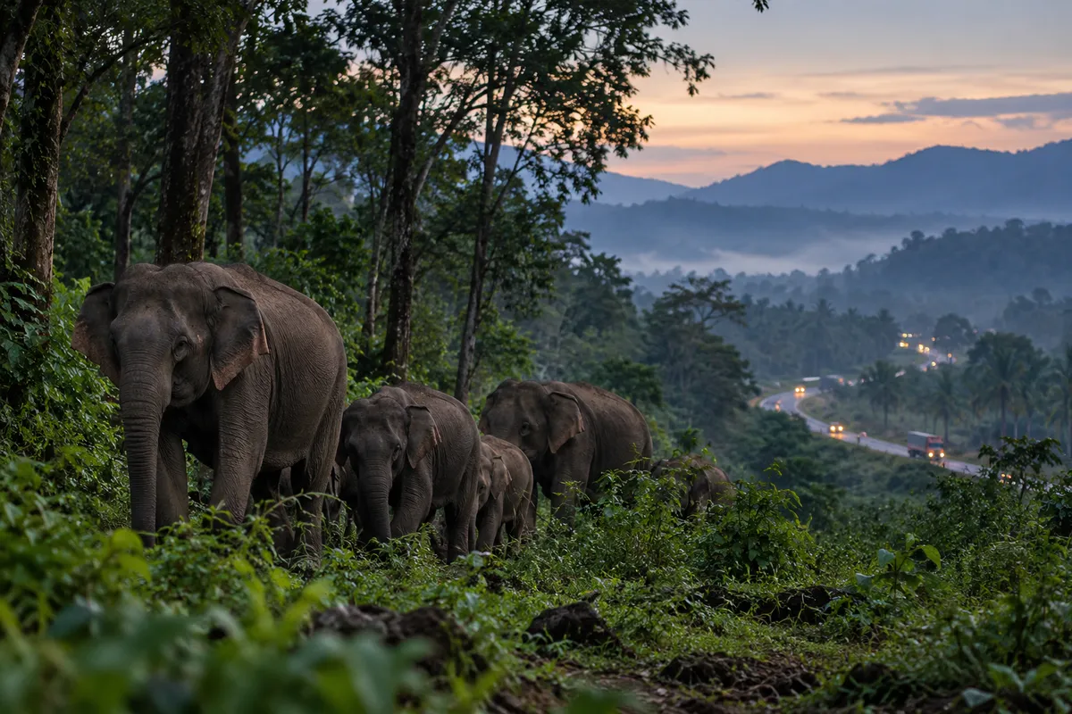
Image credit: AI-generated with OpenAI ImageGen for Humming Genesis; illustrative, not a documentary photograph.
An elephant corridor is easy to misunderstand if we imagine it as a narrow green tunnel drawn between two forests. On the ground, it can be a patchwork of scrub, farms, village edges, streams, plantations and the gaps between them. It is a route through a lived-in landscape, and its usefulness depends on whether elephants can actually move through it.
Karnataka sits at the heart of one of India’s most important elephant landscapes, linking forests across the Western Ghats and the southern plateau. The state’s forests are not a single continuous block. Roads, railway lines, settlements, agricultural land and other infrastructure create edges and obstacles. For elephants, which need to travel to find food, water, mates and suitable habitat, a barrier can turn a familiar route into a risky journey.
This is why a forest-cover map can tell only part of the story. Two large green areas may appear close together from above, but the land between them may be difficult or dangerous to cross. A herd might have to navigate a busy road, a railway line, electric fencing or fields that offer attractive crops. The corridor is not simply the strip of land between protected areas; it is the ability to move through that strip without unacceptable risk to wildlife or people.
The consequences are painfully familiar to communities living near elephant habitat: damaged crops, property loss, fear during night-time encounters and, sometimes, injuries or deaths. Elephants are also killed by electrocution, in collisions and through other human-made hazards. It is tempting to frame this as a contest between people and animals, but that leaves out the decisions that shape the encounter. Where have roads been placed? Which routes remain open? Are warning systems timely? Is compensation accessible? Are barriers maintained, and do they redirect animals into someone else’s fields?
A 2025 report by the environment ministry’s Project Elephant Division and the Wildlife Institute of India on reducing elephant–train collisions describes the scale of the challenge in Karnataka, noting the state’s elephant population, its elephant corridors and the fragmentation caused by linear infrastructure. In August 2026, the Wildlife Institute of India and Project Elephant Division released a state-level assessment of human–elephant conflict trends from 2000 to 2025. The 2026 assessment underlines a key point: conflict is not evenly spread across the landscape. It clusters around particular places and recurring pressures, which means prevention must be designed for specific locations rather than applied as a generic statewide formula.
A corridor policy that exists only on paper is not enough. The first task is to identify which routes elephants are using now, not only which ones were mapped years ago. That means combining field observations, camera-trap data, tracks, community reports, movement studies and local knowledge. The next task is to protect the land and the ability to move through it. In some places, that may involve securing a narrow pinch point. Elsewhere, it may mean redesigning a road crossing, improving a railway stretch, changing the location or operation of a barrier, or keeping development away from a known movement route.
The word corridor can make the solution sound tidier than it is. A route used by elephants may cross private holdings or pass close to homes, and securing it can raise difficult questions about land rights, compensation and future development. Those questions should be faced early, with transparent maps and discussion, rather than after an animal has been injured or a village has suffered repeated crop loss. Nor should every reported elephant movement automatically be treated as proof of a permanent corridor: seasonal movement, occasional dispersal and established routes need to be distinguished through evidence. The 2026 Wildlife Institute of India assessment is useful precisely because it examines patterns over time and identifies hotspots. It should guide local investigation, not replace it. The practical goal is to reduce risk at known pinch points while making sure that interventions do not simply shift danger to the next settlement.
There is no single engineering fix. Underpasses and overpasses can help in the right setting, but a structure is not useful simply because it appears in a project plan. Its location, dimensions, approaches, disturbance levels and connection to habitat matter. So does what happens around it after construction. A wildlife crossing surrounded by new buildings, bright lights or a fence that blocks access is a bridge to nowhere.
People living near corridors need to be part of the design, not invited in after the decisions are made. Early-warning systems must reach people in forms they can use, at the hours when elephants move. Compensation needs to be prompt, fair and understandable. Crop choices and protection measures should be discussed with farmers rather than prescribed from a distant office. If conservation asks a village to bear repeated costs for a landscape that benefits the wider public, the public has a responsibility to share those costs.
It is also worth resisting the idea that every conflict can be solved by fencing wildlife out. Barriers can reduce encounters in some contexts, but they can also obstruct movement, fail when poorly maintained or move the problem to a neighbouring community. The question should be: what combination of land protection, safe crossings, early warning, rapid response and fair support reduces harm over the long term?
The best corridor is not necessarily the one that looks most like untouched forest. It is the one that remains permeable to wildlife while being planned honestly around human lives and livelihoods. That requires cooperation across forest divisions, transport agencies, local governments and neighbouring states. Elephants do not recognise administrative boundaries, and their movements will not neatly follow the limits of a single department’s responsibility.
There is something humbling about this. We tend to see roads as connections and forests as destinations. For an elephant, the connection may be the most important part. If the route between two habitats becomes impassable, keeping both habitats green is not enough.
Karnataka’s corridor debate should therefore be about more than saving a line on a map. It should ask whether an animal can move through its ancestral landscape without being pushed into danger, and whether the people who share that landscape can live with less fear and fewer losses. The measure of success is not a corridor declared. It is a crossing that remains possible.
Sources and further reading
- Project Elephant Division, MoEFCC, and Wildlife Institute of India. “Suggested Measures to Mitigate Elephant and Other Wildlife Train Collisions on Vulnerable Railway Stretches in India,” Technical Report TR No./2025/02, March 2025; Karnataka section, pp. 88–98. https://moef.gov.in/uploads/2025/07/Elephants_Railways_Mitigation_Planning_March_2025_Final.pdf
- Habib, B., A. Nath, M. Chand et al. “Human-elephant conflict in the State of Karnataka, India (2000–2025): Trends, Challenges and Insights,” Wildlife Institute of India and Project Elephant Division, MoEFCC, Technical Report TR-0040-2026, released August 2026. https://wii.gov.in/uploads/media/pdf/documents/Human_Elephant_Conflict_Karnataka_2000_2025.pdf
- Wildlife Institute of India and Project Elephant Division, MoEFCC. “Regional Action Plan for Comprehensive Understanding & Management of Human-Elephant Conflict in South India,” 2026. https://wii.gov.in/news/rap_for_comprehensive_understanding_management_human_elephant_conflict_in_south_india_technical_report_2026_release